When studying volcanoes, detecting even the slightest movements of the land surface can tell a lot about what is happening below. The ground rises and falls—expands and contracts—with the movement of magma in subterranean chambers. But detecting the amount and location of such subtle movements is difficult.
Remote sensing scientists at NASA’s Jet Propulsion Laboratory have a new tool to observe such ground deformation. The Uninhabited Aerial Vehicle Synthetic Aperture Radar (UAVSAR) sends pulses of L-band microwave energy from an aircraft-mounted sensor to the ground. Those microwave signals bounce back to the sensor and get translated into observations of land cover and topography, regardless of whether there are clouds.
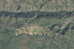
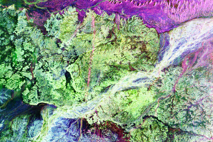
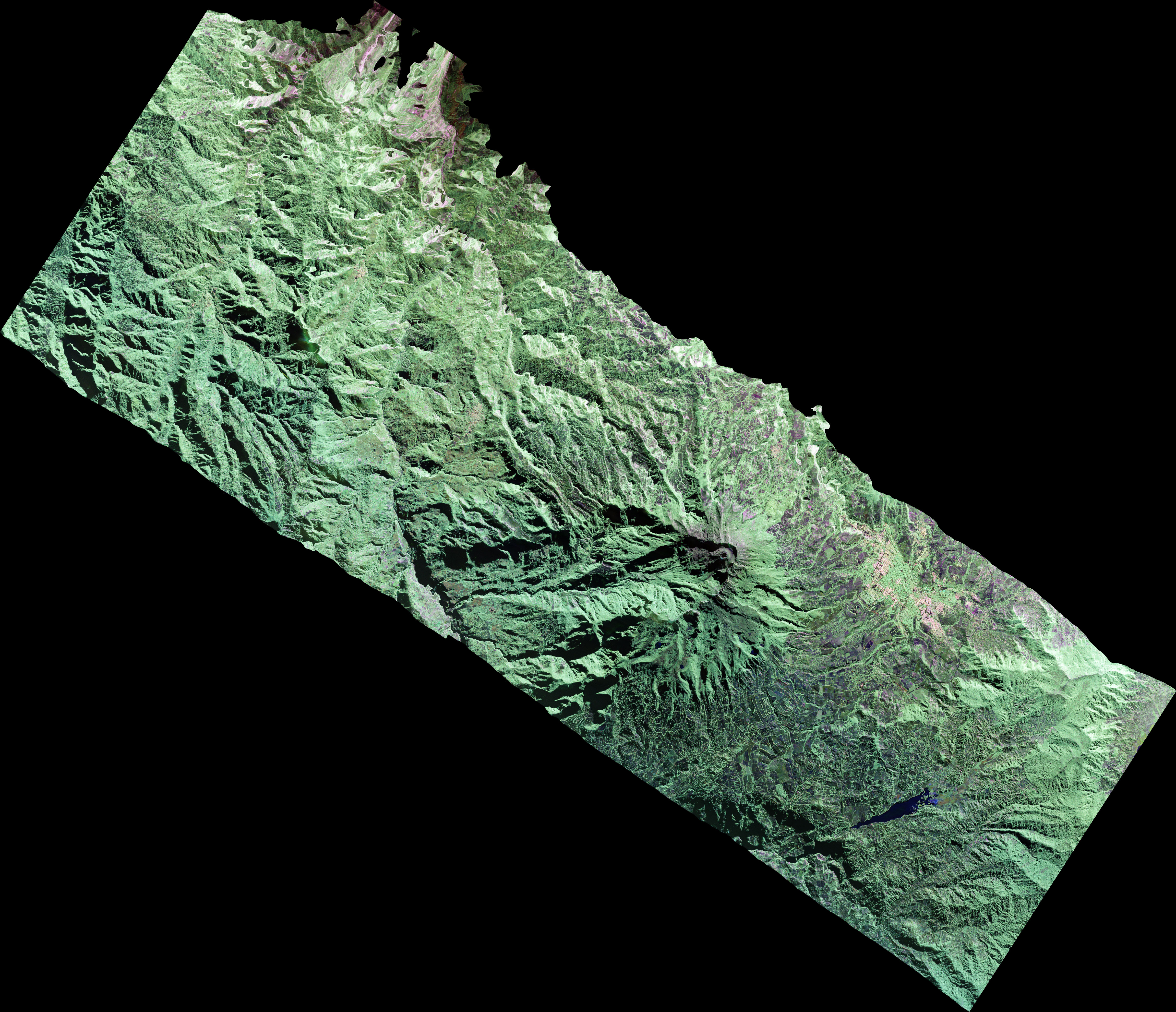
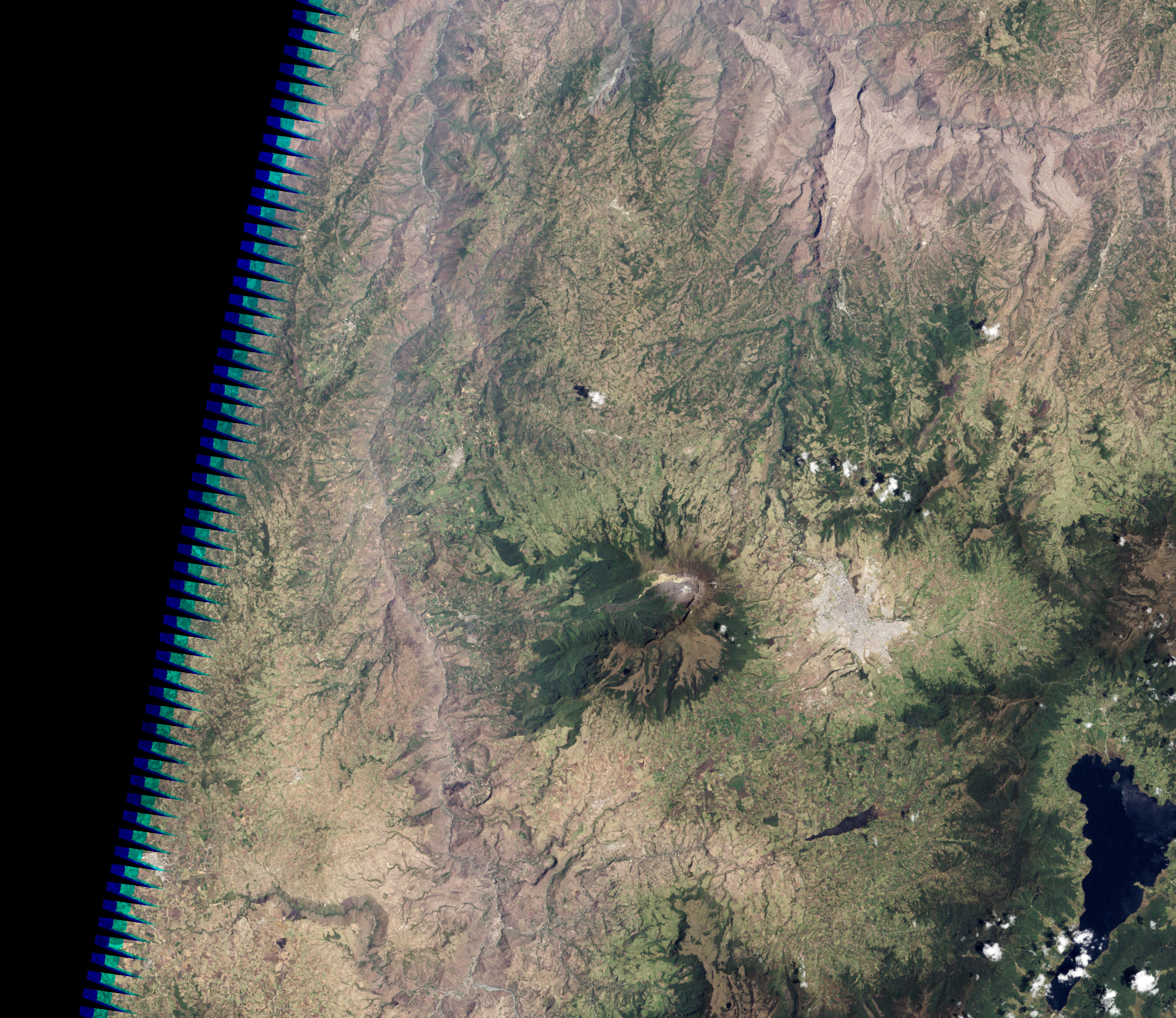
UAVSAR captured the data for the top, false-color image on March 13, 2013, while flying on a NASA Gulfstream C-20A aircraft. The radar penetrated the tropical tree cover to detect the shape of the land surface around Galeras volcano and the city of Pasto, Colombia. UAVSAR uses microwaves instead of visible light to make images of the land surface at a spatial resolution of 6 meters (20 feet) per pixel.
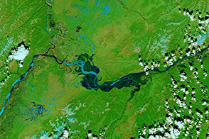
For comparison, the second image shows roughly the same area in natural color on a rare cloud-free day in 2002, as observed by the Enhanced Thematic Mapper Plus (ETM+) on the Landsat 7 satellite. (The resolution of Landsat 7 is 30 meters per pixel.) Note how the UAVSAR image gives more sense of the three-dimensional structure and slope of the land.
By itself, a single UAVSAR image has some utility for studying soil moisture, vegetation cover, wetlands, and other landscape patterns, particularly in areas with a lot of cloud cover or dense forests. The real payoff for solid earth sciences comes from having two or more of these images, noted Naiara Pinto, UAVSAR science coordinator at JPL. “UAVSAR images can be used as part of a technique called InSAR—interferometric synthetic aperture radar—through which we can measure surface deformation to sub-centimeter accuracies.” By examining the interference patterns between multiple images, scientists can see the changes in Earth’s surface caused by volcanic deformation.
SAR instruments have been flown periodically on satellites and the space shuttle. “However, airborne studies allow us to measure crustal deformation with flexible time intervals and viewing geometry,” said Pinto. “You can learn more about the process and improve existing methodologies.”
Galeras was chosen for observation because of its proximity of the city of Pasto and because it has erupted several times over recent centuries, most recently in 2009–2010. The volcano has a breached caldera and an active cone that can produce explosive eruptions. “Galeras is a highly active volcano, and just one of many that we are targeting in order to establish baseline observations that will allow us to measure background levels of volcano activity and be in a position to respond in case of future large eruptions,” said Paul Lundren of JPL.
The research team will return to Galeras and to other locations in Central and South America in the spring of 2014. With that second round of measurements, Lundgren and other geophysicists will be able to use interferometry to see if and how Galeras is changing.
Radar image by NASA Jet Propulsion Laboratory/California Institute of Technology. Landsat image created by Robert Simmon/NASA Earth Observatory, using Landsat data provided by the U.S. Geological Survey. Caption by Michael Carlowicz.