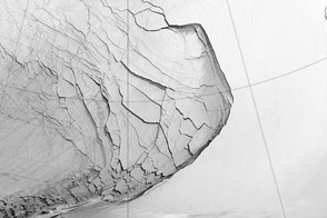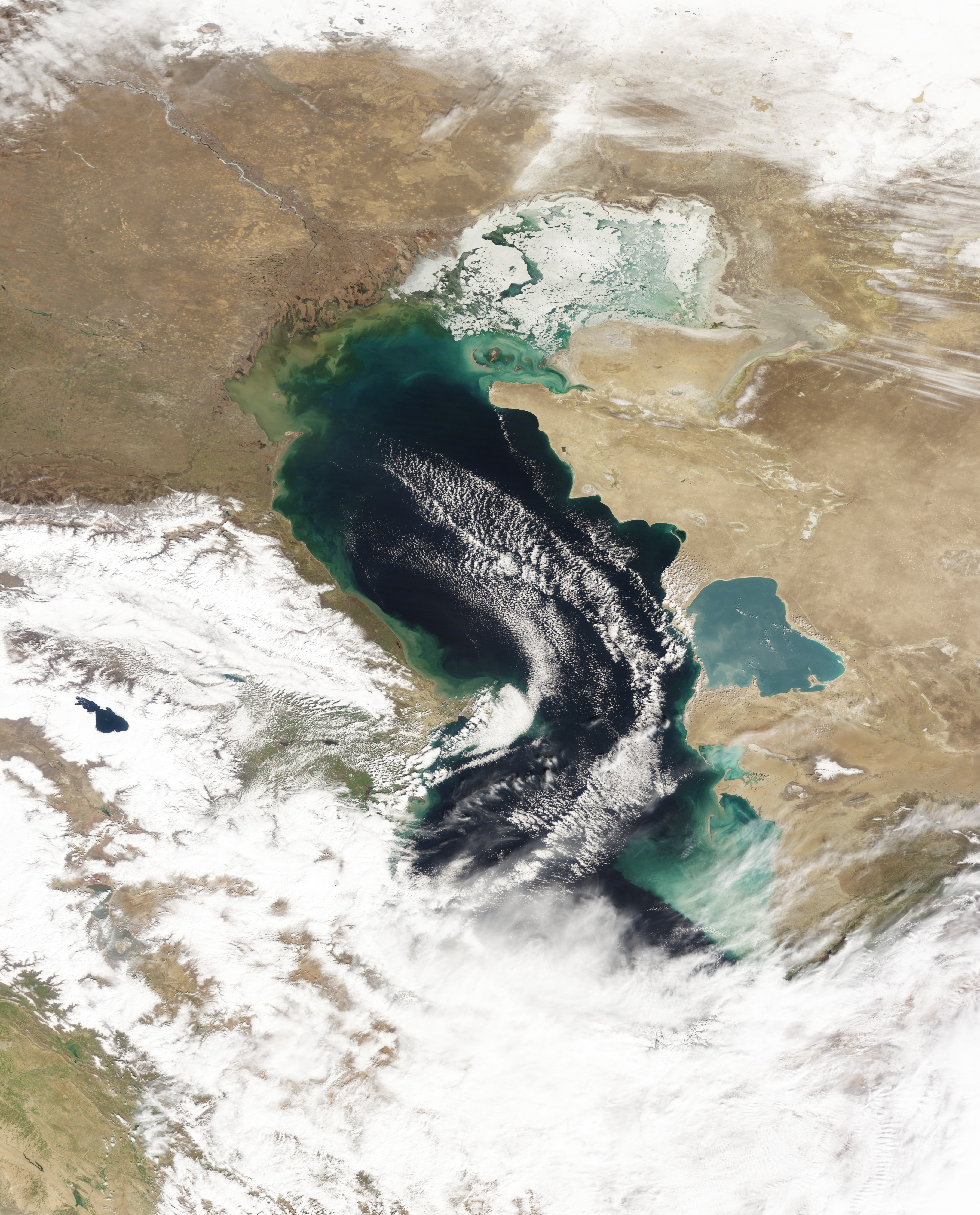

The Caspian Sea isn’t really a sea but in fact a giant lake that spans roughly 1,000 kilometers (600 miles) from north to south. In the winter, ice often forms over the lake’s northernmost reaches, while the central and southern parts remain ice free. Temperatures are generally lower in the north, so you might guess that the ice owes its existence purely to the higher latitude. But the reality is more complex: From north to south, the Caspian Sea also exhibits differences in salinity and depth.
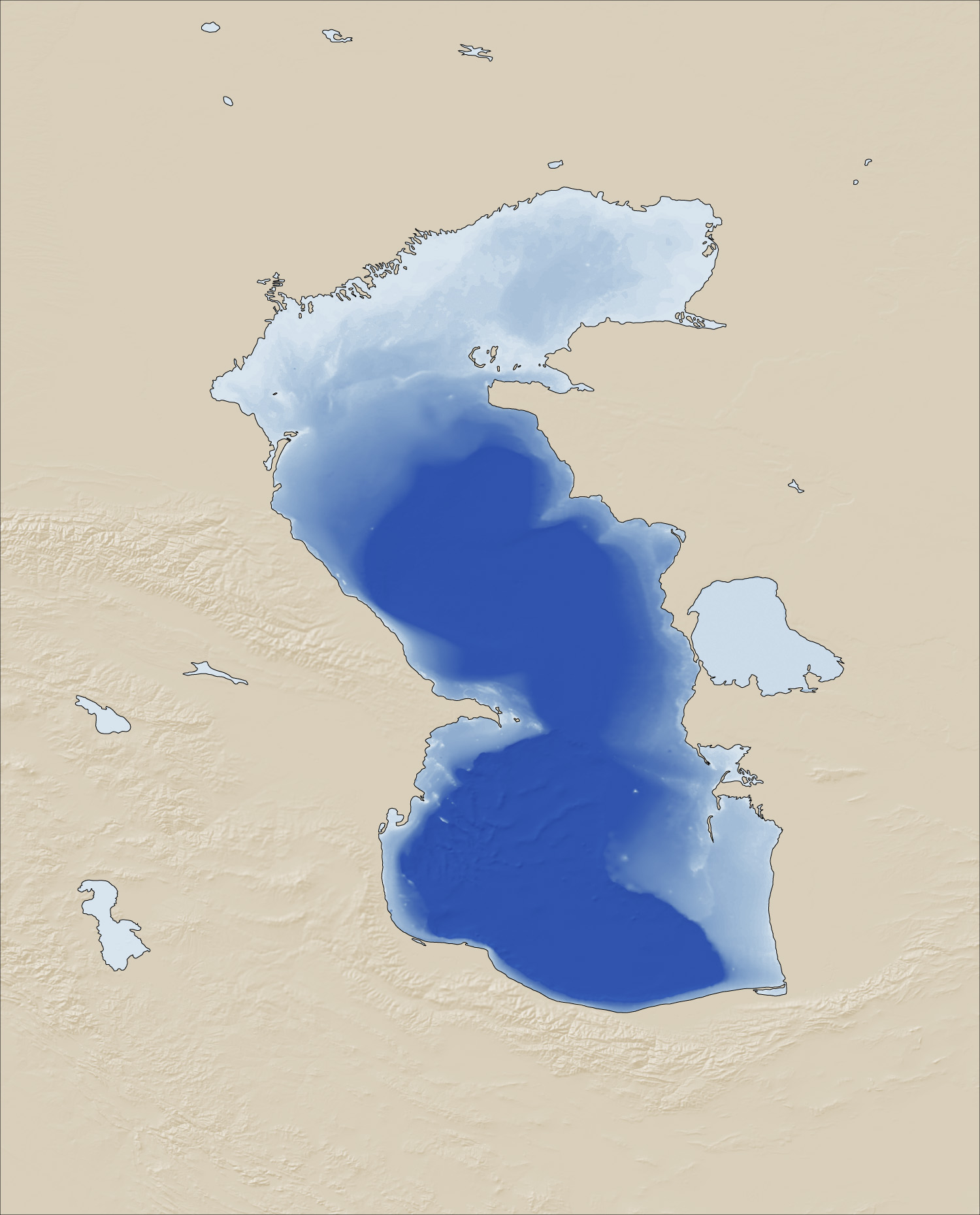
The Moderate Resolution Imaging Spectroradiometer (MODIS) on NASA’s Terra satellite captured a natural-color image of ice on the northern Caspian Sea on March 7, 2013 (top). The map (bottom) shows the bathymetry, or depth, of the northernmost part of the sea. Darker shades of blue indicate greater depth.
The differences in depth in the Caspian Sea are stark. Most of the northern part of the sea has a depth of 10 meters (30 feet) or less. Roughly west of Poluostrov Mangyshlak (the Mangyshlak Peninsula, or Tüpqaraghan Tübegi), depth begins to increase. In the southern part of the Capsian Sea, depth is measured in hundreds of meters, with some areas exceeding 1,000 meters (3,000 feet).
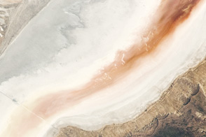
The Caspian Sea also shows varying levels of salinity. Overall, it is about one-third as salty as the ocean. The water is saltiest in the south and freshest in the north. Roughly 130 rivers feed the giant lake, and nearly all of them enter from the north or west. The biggest is the Volga, which enters the Caspian Sea from the northwest, bringing a generous supply of fresh water.
Fresh water freezes at 0 degrees Celsius (32 degrees Fahrenheit), but since the Caspian is brackish, temperatures must fall below that for salt water to freeze. For every five parts per thousand salt content (salinity), the freezing point drops by 0.28 degrees Celsius (0.5 degrees Fahrenheit).
A lower freezing point is not the only impediment to the freezing of salt water. Salty water behaves differently than fresh water, hampering the formation of an ice layer at the surface.
Ice floats because liquid water is denser than ice. But liquid water is not uniform in its density. Fresh water is densest at 4° Celsius (39° Fahrenheit), several degrees above its freezing. As it cools below 4°C, it starts to rise toward the surface. If a layer of ice has already formed at the lake surface, this cooling and rising water can easily freeze onto the bottom of that ice.
Salt water, in contrast, typically reaches its maximum density closer to its freezing point. Because salt water usually sinks just before it is about to freeze (rather than rising), more of the water column must cool down before salty water can form an ice layer.
In the shallower part of the Caspian basin, water more readily cools throughout the water column than in the deeper parts. So the shallower northern section facilitates freezing.
NASA Earth Observatory images by Jesse Allen and Robert Simmon, using data from the Level 1 and Atmospheres Active Distribution System (LAADS), and ocean bathymetry data from the British Oceanographic Data Center’s Global Bathymetric Chart of the Oceans GEBCO_08 Grid, Version 20100927. Caption by Michon Scott, with information from Walt Meier, National Snow and Ice Data Center.