
Weather fronts are as familiar as rain. For those who live outside of Earth’s tropics, the movement of warm and cold masses of air creates the weather, and when the two clash, it often rains. Understanding what happens when cold and warm air meet (cold and warm fronts) has given meteorologists the ability to predict the weather.
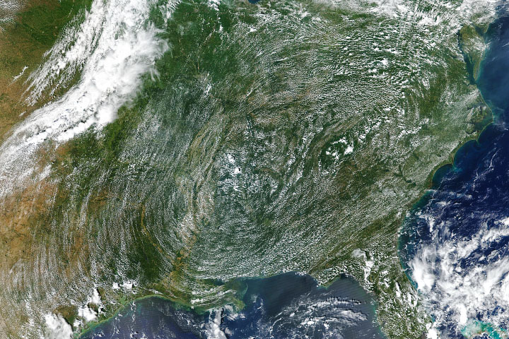
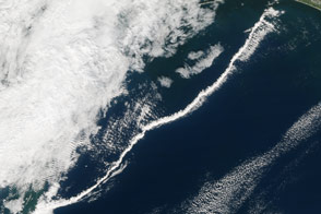
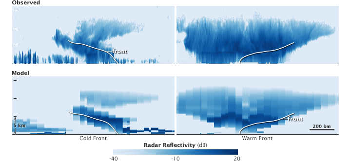
But for all of their familiarity with fronts, scientists have only recently gotten a detailed view of them. These four images contrast computer models of weather fronts (lower images) with the view from NASA’s Cloudsat (top), a space-based radar. The radar instrument on the satellite provides a detailed view of the cloud structure and precipitation in the clouds, helping scientists refine their understanding of common weather patterns and improve their ability to predict the weather.
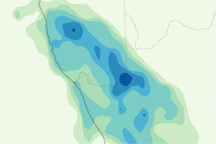
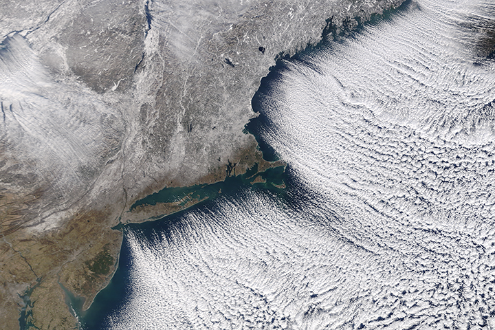
The left image pair shows a cold front moving from left to right into a warm mass of air. The cold, dense air lifts the warm air like a wedge. The rising, warm air forms distinctive anvil-shaped clouds, visible in both the satellite and model image. Along the leading edge of the front, the rising air can develop into intense thunderstorms with heavy bursts of rain if there is enough moisture in the air.
Rain droplets send a stronger radar signal back to the satellite. This means that areas of heavy rain are dark blue, while lighter rain is lighter in color. The Cloudsat image shows a single area of concentrated rain surrounded by a line of lighter rain. The less detailed model shows a broad swath of rain. Cloudsat also reveals a line of low, rain-producing clouds behind the front that the model missed.
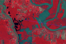
The right image pair shows a warm front moving from left to right over a cold mass of air. In this case, the lighter, warmer air lifts gradually over the cold air. The rising air cools and condenses into a wide area of clouds and steady rain. While both the satellite and the model detect the rain (shown in dark blue), Cloudsat shows more rain over a wider area.
Cloudsat launched on April 28, 2006, and began to take measurements a little over a month later. The moment the satellite turned on, its first image showed the structure of both a cold front and a warm front in detail scientists had never seen before. In the five years since, the instrument has provided numerous observations of cloud structures, from the unusual—hurricanes—to the mundane, common fronts.
NASA image created by Jesse Allen, using CloudSat data provided courtesy of the Derek Posselt and the CloudSat team at Colorado State University. Caption by Holli Riebeek