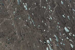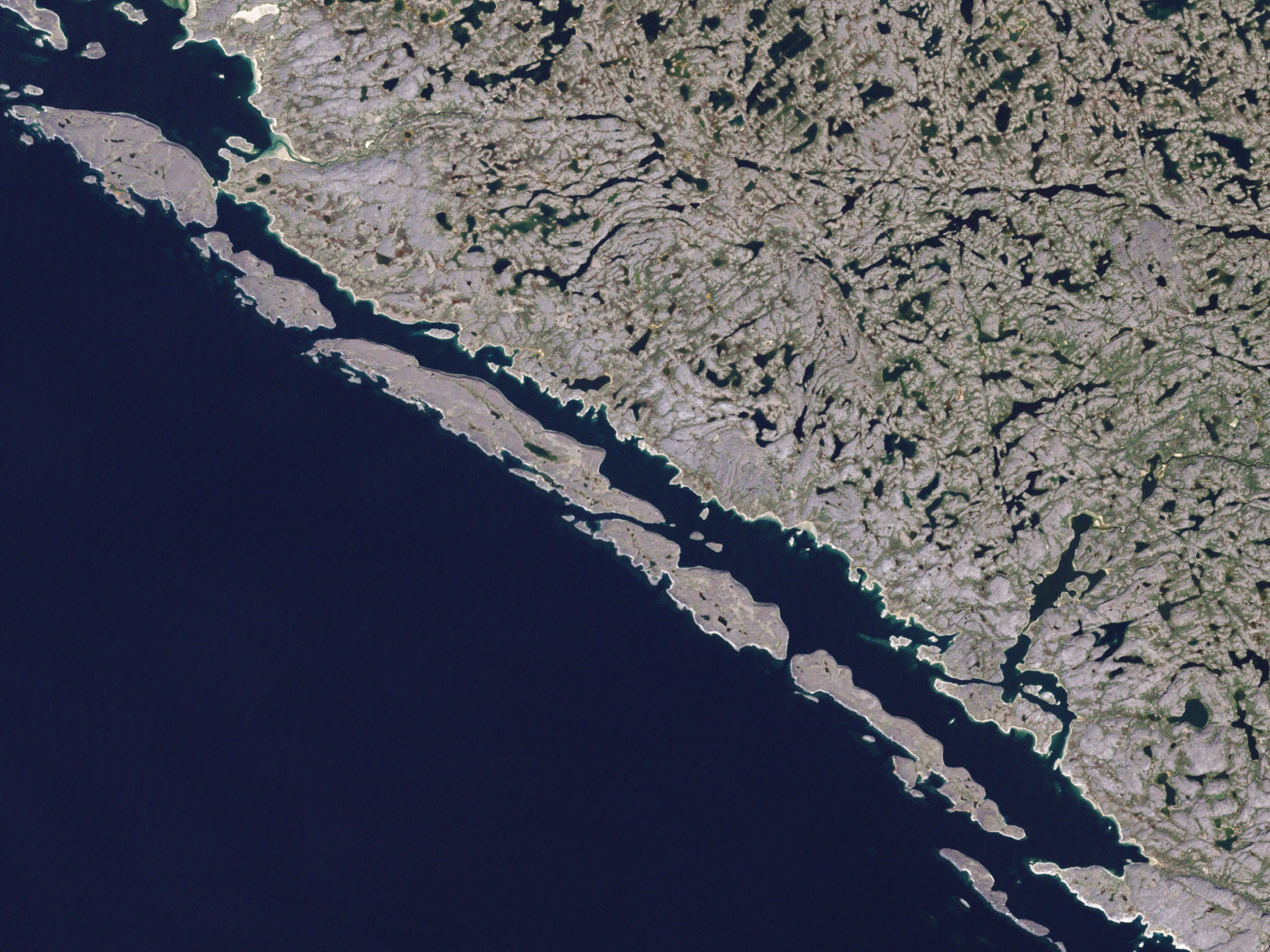
It stretches the imagination to picture the massive sheets of ice that spread down out of the Arctic and engulfed Canada and the northern parts of the United States at the height of the last ice age, about 20,000 years ago. But the land around Hudson Bay, Canada, known to geologists as the Canadian Shield, provides some of the most dramatic evidence of the passage of those ice sheets across North America.
This image from NASA’s Landsat Enhanced Thematic Plus sensor shows part of the Canadian Shield in northwestern Quebec, along with the Hopewell Islands, on September 8, 2000. During the ice age, the surface here was alternately scoured of vegetation and soil as ice sheets advanced, and then carved and rinsed by meltwater as ice sheets retreated. The impact of this scouring is evident on the terrain. The area has little topsoil and sparse vegetation. Hundreds of lakes and twisting streams mark the surface, as if the water has not yet figured out how to drain.
The erosion of the Canadian Shield was so complete that the earth was scraped down to basement rock, and a vast area of Earth’s most ancient continental crust is exposed at the surface. This exposure recently allowed a team of Canadian-led scientists to discover what may be the oldest preserved piece of Earth's first continental crust, a belt of rock known as greenstone, which has an estimated age of 4.28 billion years. The area where the rock was found is just southeast of the center of this image.
NASA image created by Jesse Allen, using Landsat data provided by the United States Geological Survey. Caption by Rebecca Lindsey.