|
Astronaut Photography Background
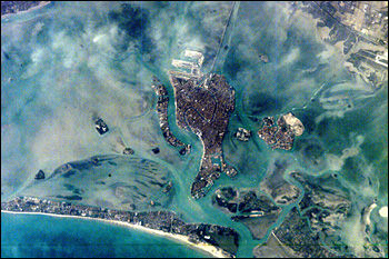
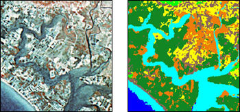
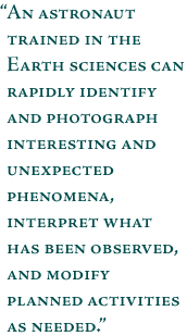
Astronauts are trained in scientific observation of ecological, geological, geographic, oceanographic, environmental, and meteorological phenomena. They are also instructed in the use of photographic equipment and techniques. Preflight training helps the astronauts make informed decisions on which areas and phenomena to photograph. Specific areas of scientific interest are selected before each flight by a group of scientists. The astronauts receive intensive training, in-flight aids, and messages from the ground to help them locate these sites that are of scientific interest. An astronaut trained in the Earth sciences can rapidly identify and photograph interesting and unexpected phenomena, interpret what has been observed, and modify planned activities as needed. Near real-time information exchange between the crew and scientists expedites the recording of dynamic events of geological, oceanographic, environmental, and meteorological importance. Critical environmental monitoring sites are photographed repeatedly over time; some have photographic records dating back to the Gemini and Skylab missions. Earth limb pictures taken at sunrise and sunset document changes in the Earth’s atmospheric layers. Photographs of hurricanes, thunderstorms, squall lines, island cloud wakes, and the jet stream supplement weather satellite images by offering high-resolution stereoscopic coverage of such phenomena. Astronaut photography provides several unique contributions to the range of Earth Science information available from NASA (Lulla et al. 1996). First, the images are readily accessible to the public — they are non-proprietary, can distributed in digital form on the Internet (at the Gateway to Astronaut Photography of Earth), and are in a real-color photographic form that is easily interpretable by non-scientists. Second, the unique aspects of handheld data make it possible to view the Earth in ways that are not common from other sensors. In addition to images looking directly down at the ground, astronauts can look obliquely at haze in the atmosphere, or use sunglint to view water boundaries and wave features. Third, because the photographs are in the public domain, they provide a low-cost alternative data source for cases where other satellite imagery cannot be acquired or is not sufficient. Such cases often include studies in developing countries, in areas that have not usually been targets for major satellites, needing supplemental low-cloud data, requiring a time series, or requiring a large number of images. Photographic Characteristics Summary
More information on astronaut photography Scientific publications using astronaut photography next: References |
About Human Spaceflight
|